The Los Pavitos Project
Location
The Los Pavitos Project is located in the Alamos region of southern Sonora State. There are several active exploration and mining projects in this well-endowed mineralized region.
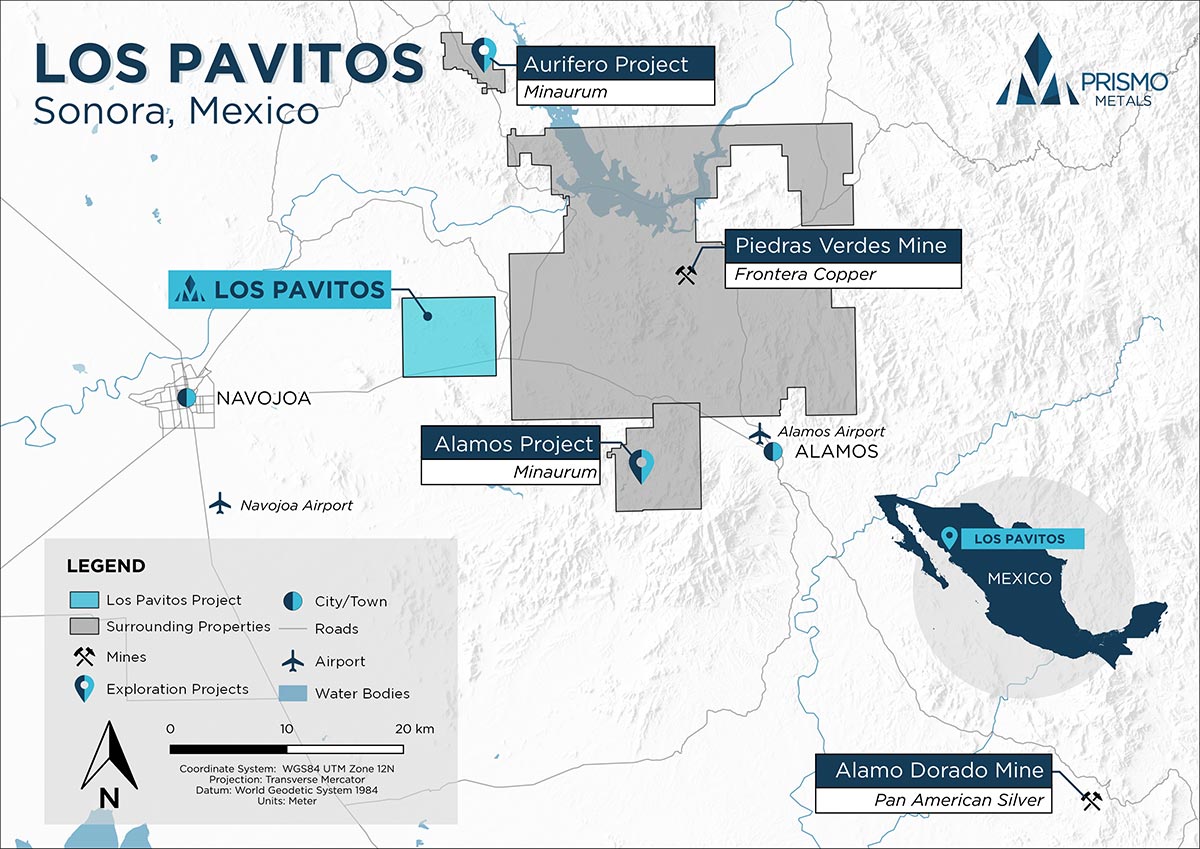
The Los Pavitos Property location in Sonora State, northwestern Mexico.
Mineral Concessions and Agreements
Los Pavitos is an early-stage exploration project located in the Álamos area of Sonora State, Mexico. The project consists of one concession, Los Pavitos Reducción, that covers 5,289 hectares. The concession is located on the paved highway between Navajoa and Álamos at about the 17 km marker, and the main mineralized area is about 6 km North of the highway and are reached by unmaintained dirt roads that access local ranches. Several interior concessions owned by third parties cover mineralized occurrences within the boundaries of the Los Pavitos concession.
On October 11, 2019, the Company entered into an Option Agreement with Minera Cascabel (the “Cascabel Option”). Pursuant to the terms of the Cascabel Option, Cascabel grants the Company an option to earn up to 100% in the Los Pavitos concession, located in the state of Sonora, Mexico, over a period of five years. To exercise the Cascabel Options, the Company is required to incur USD $1.5 million in exploration expenses over the five-year period of the Cascabel Option (of which CAD $ 210,000 has been incurred to date), pay an additional USD $500,000 Cascabel and issue to Minera Cascabel an additional 2,000,000 common shares.
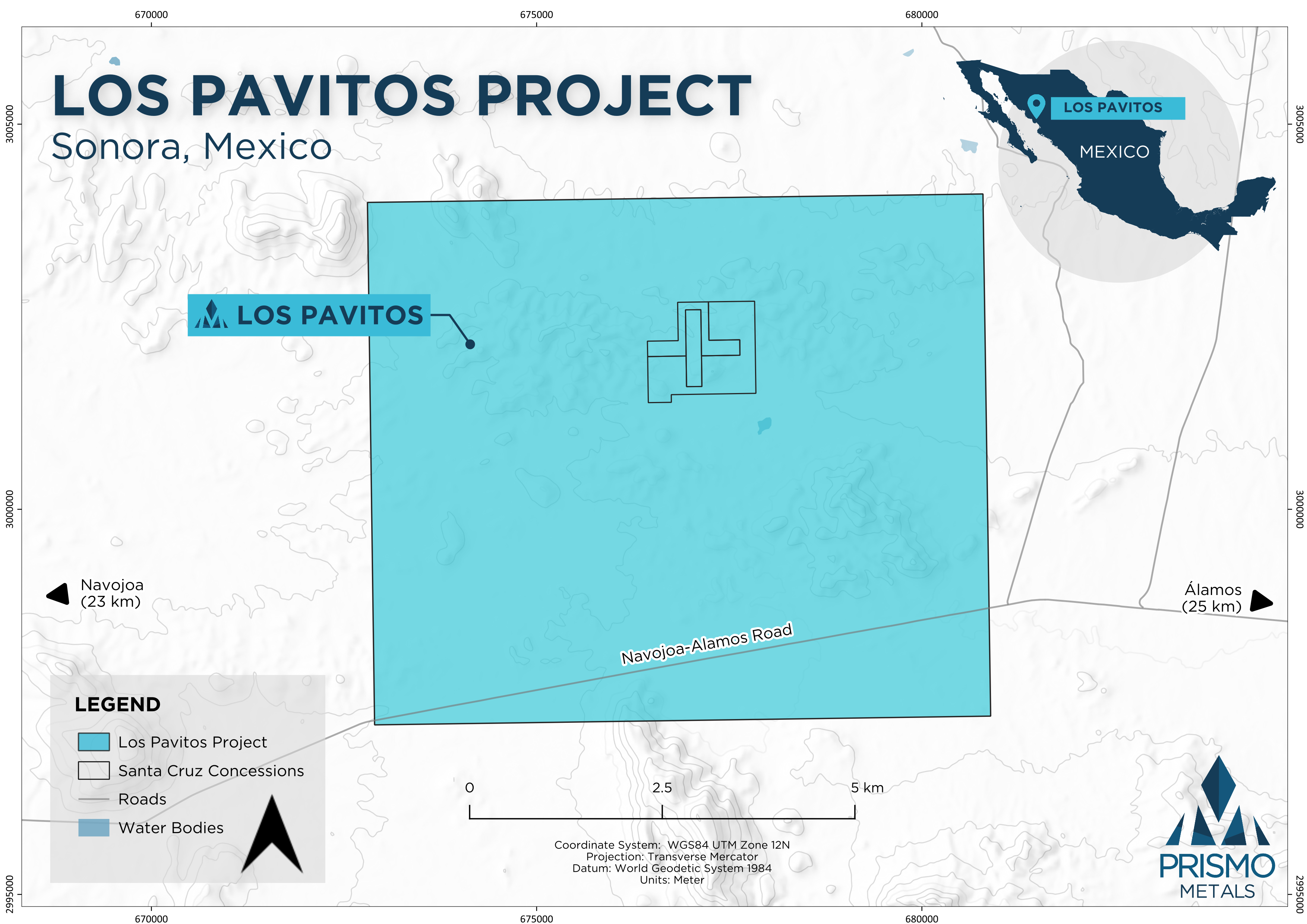
The Los Pavitos Property consists of Los Pavitos Reducción concession (shown in blue) covering 5,289 hectares. Located approximately 23 km and 25 km from the city of Navojoa and town of Álamos, respectively.
History
Minera Cascabel staked the concession in 2012, and has completed reconnaissance mapping and sampling programs. Numerous small mines and prospect pits attest to past mining and exploration, but little historical information is available.
Los Pavitos is a relatively early stage exploration project. Several campaigns of sampling and reconnaissance work have been carried out by Minera Cascabel and other companies.
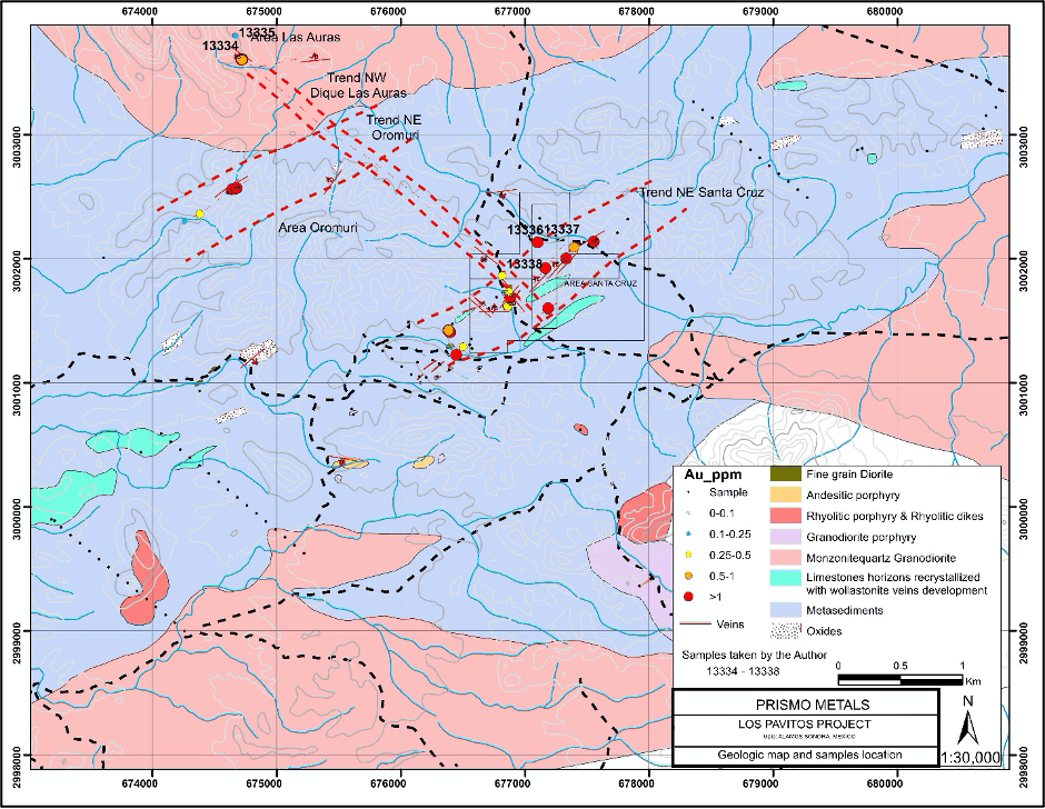
Geologic map of the Los Pavitos project.
Exploration
Geologic mapping has further refined several principal structures that define the Las Auras, Santa Cruz and Oromuri structural trends that were identified during reconnaissance work by Minera Cascabel, the Mexico based company Prismo optioned the property from in October 2019. Several additional new parallel structures have been recognized, including the La Española, San Jorge and La Ramada faults. Areas of strong oxidation occur along and around several of the structures and at structural intersections.
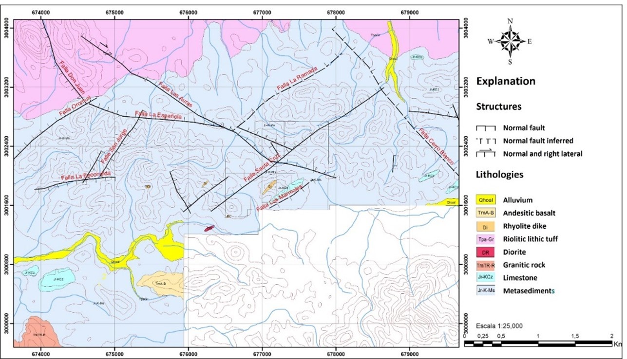
Figure 1. Geologic map of the Los Pavitos project showing strong northwesterly orientation of faults hosted largely by metasediments.
Assay results have been received for 169 samples with the best results from the Las Auras and Santa Cruz areas with individual samples yielding 10.15 and 28 g/t gold, respectively (See Highlights table below).
Table 1. Selected assays, Los Pavitos project.
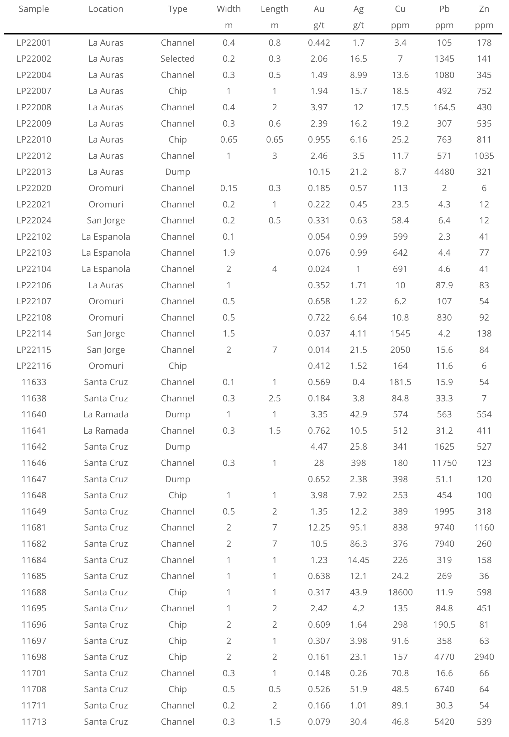
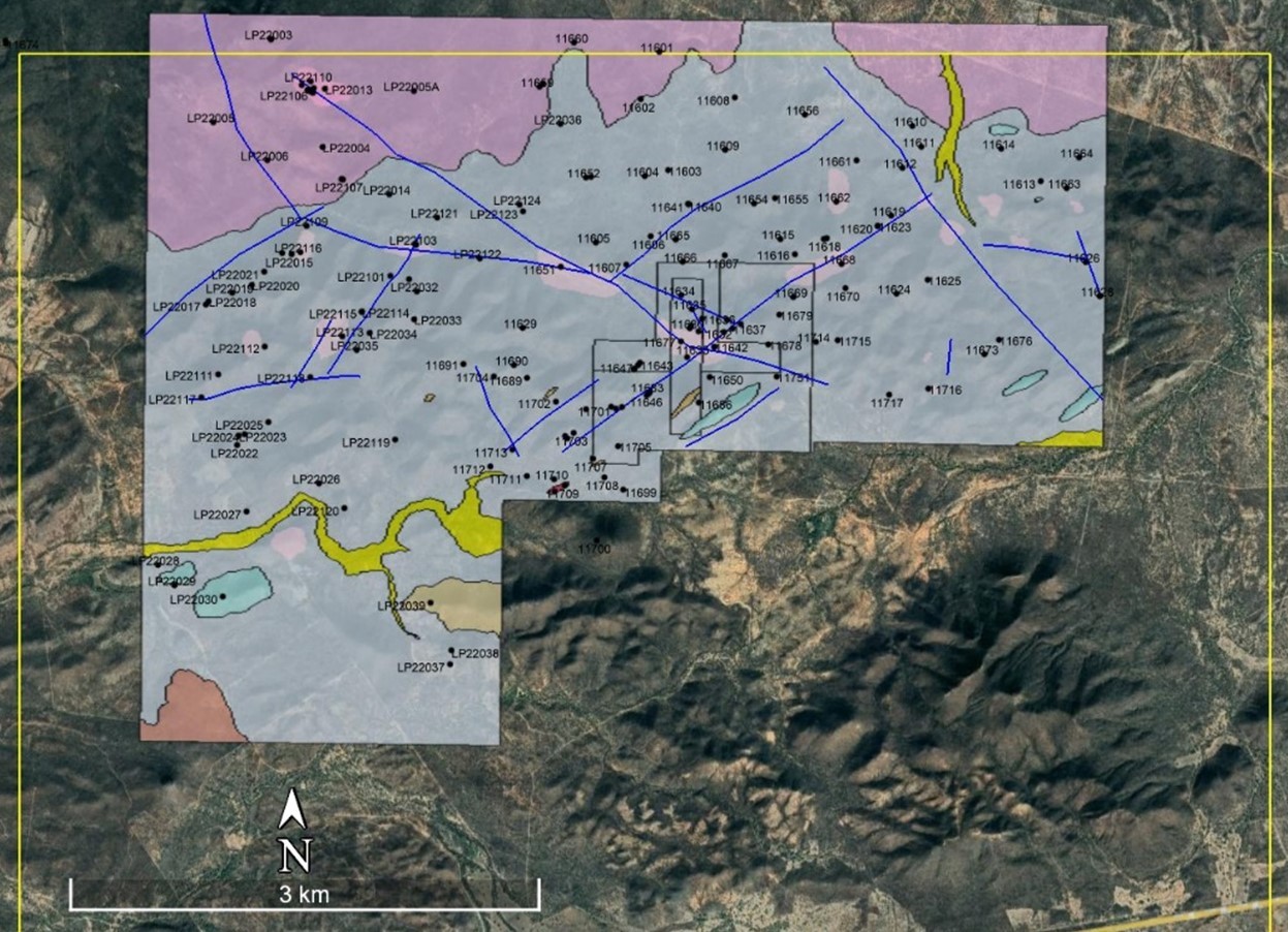
Figure 2. Samples taken by the company at Los Pavitos.

Figure 3. Gold distribution for samples taken at Los Pavitos.
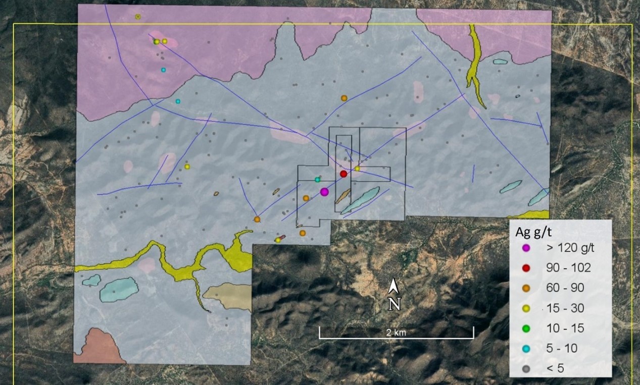
Figure 4. Silver distribution for samples taken at Los Pavitos.
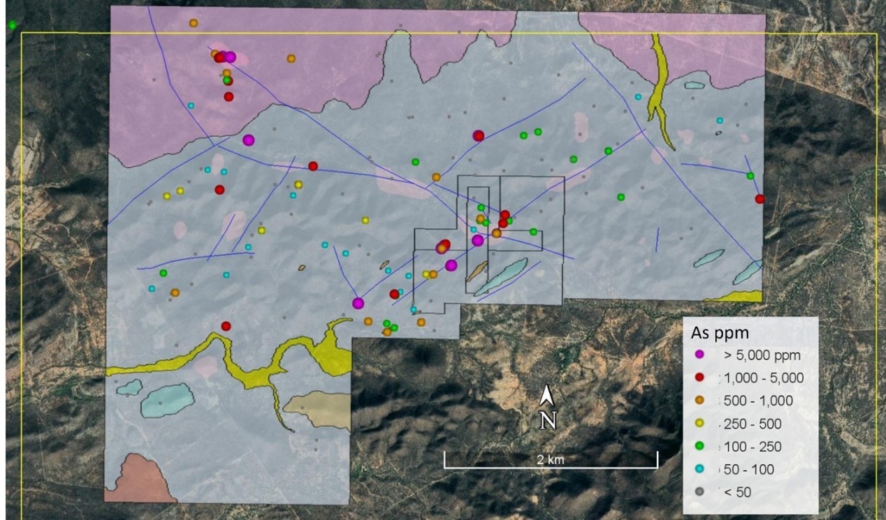
Figure 5. Arsenic distribution for samples taken at Los Pavitos.
Zone 1: Santa Cruz area
Santa Cruz lies at the intersection of the Santa Cruz fault with the Las Auras fault and is currently the principal known mineralized area. The area is partially covered by small third-party internal concessions where numerous small pits, mines and trenches are present. Highlighted samples taken by the Company in this area range from 0.15 to as much as 28 g/t gold, generally with low silver values, but with one sample yielding 398 g/t silver for a 1-meter sample. Historic sampling yielded as much as +10g/t Au and 59.8 g/t Ag from a dump sample, and a sample from the Hedionda mine taken for the Los Pavitos Technical Report (see news release or March 19, 2021) yielded 8.3 g/t Au and 62 g/t Ag for a 0.25 m channel sample.
Zone 2: Española-La Auras-Ramadas intersection
The Española structure is a newly recognized fault approximately parallel to the Las Auras trend. The northeast trending La Ramada fault also intersects the Las Auras fault in this area. A large area of iron oxide alterations is present in the area where the Las Auras and La Española structures meet. Samples taken to date mainly have yielded anomalous As values.
Zone 3: Española-San Jorge intersection
The San Jorge fault appears to be a third mineralized structure parallel to the Orimuri and Santa Cruz trends with several prospects present in the area near the newly recognized Española and San Jorge faults. Sampling to date has yielded mainly anomalous Cu and As from the Española mine workings.
Zone 4: Santa Cruz-Cerro Blanco
The Santa Cruz-Cerro Blanco area is located in the northeastern portion of the Los Pavitos Concession. The area is covered by reddish soil, but no detailed work has been carried out yet. Sparse sampling has yielded anomalous Cu and As.
Zone 5: La Auras area
Las Auras consists of NW trending oxidation area with quartz veining located in the northwestern corner of the Los Pavitos concession. Several samples taken by the Company in the area yielded high gold values, with the highlighted samples ranging from 0.1 to 10.15 g/t gold from a grab sample and 3.97 g/t gold for a 2 m chip sample. Historic sampling yielded samples ranging from anomalous to 40.8 g/t gold and 99 g/t silver from a 0.3 m channel sample.
Mineralization Model
The current exploration work is partly directed towards determining whether mineralization is related to an orogenic gold deposit related to a southerly extension of the Caborca Orogenic Gold Belt of northeast Sonora, as suggested by the type of host rocks, or whether the mineralization is more similar to that in the Alamos epithermal vein district 25 km to the southeast. The presence of large northwesterly trending shear zones, quartz textures in veins and the association of gold with arsenic and bismuth supports the orogenic gold model, but more work is necessary to be definitive.
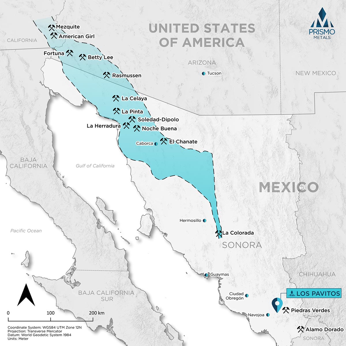
Figure 6. Location of the Los Pavitos project in southern Sonora State in relation to the Caborca Orogenic Gold Belt.
